Creative and cost-effective solutions to geospatial challenges
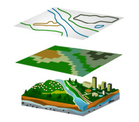
SBL Geospatial can assist your organisation with accurate and detailed mapping services, digitisation of map and drawing archives, gis data capture, photogrammetry, image georectification, Lidar DTM & DSM processing, feature extraction, CAD & GIS data conversion and modelling, the development of bespoke gis web mapping applications, or geospatial data analysis. We also provide 3D visualisation and modelling services for geological, hydrological, geochemical and hydrochemical investigations. SBL Geospatial will work with your own technology choices or our GIS specialists can advise on the best technologies to fulfil your requirements. Our team of developers have extensive experience with ESRI ArcGIS, Mapserver, Mapfish, Open Layers, Oracle Spatial and PostGIS databases.
SBL Geospatial has successfully delivered projects for clients in a range of industries including mining, agriculture, fisheries, forestry, flood management and hazard mitigation, market research, transport, utilities, sewage, banking and insurance. Our methodology for managing outsourced projects, underpinned by our ISO9001 quality accreditations, ensures that we gain a rapid and precise understanding of your requirements and deliver high-quality solutions against demanding deadlines while offering exceptional cost advantage.
In conjunction with our data partners, we are also able to commission aerial photography and lidar data. Please contact our UK Consultancy team to discuss your requirements.